View the Queens Parade heritage walk on Google Maps.
Download the Queens Parade heritage walk (PDF 3.6MB) to print.
This walk will take approximately 2.5 to 3 hours to complete. This walk covers a considerable distance, so you may prefer to walk sections on separate occasions.
About Queens Parade
Prior to 1850, Queens Parade was a track that linked Melbourne to Heidelberg in the east and forked northwards to link to Northcote and the Plenty River district. It was known as Heidelberg Road, and the northern fork as Plenty Road, until renamed in the early 1900s.
Queens Parade formed part of the boundary between Clifton Hill and North Fitzroy. Lots on Queens Parade sold from 1865 to 1869, but it remained largely undeveloped until after 1875 with Daintons Family Hotel (later the Normanby Hotel) and the commencement of building work on the St. John’s Roman Catholic Church complex in 1876.
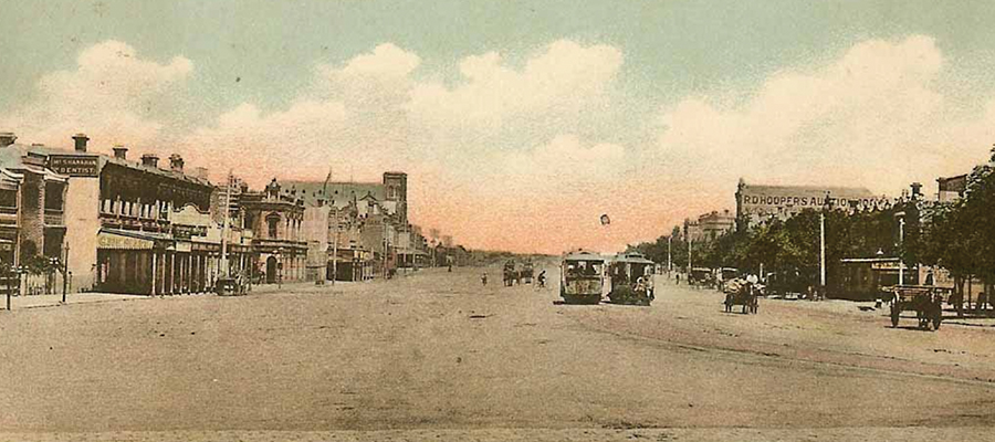
Cable tram service commenced in 1887 with terminus and tram sheds adjacent to the Terminus Hotel at the Merri Creek (see 492 Queens Parade).
Queens Parade is a good example of the mix of land uses in the inner city where sections of the parade have been used by industry, housing, retail, and community facilities.
View the Queens Parade heritage walk on Google Maps.
Download the Queens Parade heritage walk (PDF 3.6MB) to print.
This walk will take approximately 2.5 to 3 hours to complete. This walk covers a considerable distance, so you may prefer to walk sections on separate occasions.
About Queens Parade
Prior to 1850, Queens Parade was a track that linked Melbourne to Heidelberg in the east and forked northwards to link to Northcote and the Plenty River district. It was known as Heidelberg Road, and the northern fork as Plenty Road, until renamed in the early 1900s.
Queens Parade formed part of the boundary between Clifton Hill and North Fitzroy. Lots on Queens Parade sold from 1865 to 1869, but it remained largely undeveloped until after 1875 with Daintons Family Hotel (later the Normanby Hotel) and the commencement of building work on the St. John’s Roman Catholic Church complex in 1876.
Cable tram service commenced in 1887 with terminus and tram sheds adjacent to the Terminus Hotel at the Merri Creek (see 492 Queens Parade).
Queens Parade is a good example of the mix of land uses in the inner city where sections of the parade have been used by industry, housing, retail, and community facilities.